logo

logo

Travel

barn drawing

Where are you?

  • On Google Maps, Apple Maps, and OpenStreetMap.
  • On the UK Ordnance Survey, we're at grid reference SU 933 479.
  • On a planetary scale, we're at 51.222696°N, 0.665896°W.
  • We're on the National Cycle Network NCN22 - see the Sustrans map and search for "Puttenham".
  • What3words: excellent.width.rattler.
  • Puttenham village is in the west of Surrey and we're directly opposite the historic parish church. See the street map.
  • We're on the local Oaktree Routes maps - look for the Puttenham and Pudmore sheet.
  • Our postal address: The Street, Puttenham, Guildford, Surrey, GU3 1AR, United Kingdom.

Public Transport Information

Rail - nearest stations: Wanborough (2 miles), Farncombe (4.5 miles), Guildford (5 miles), Godalming (5 miles) and Farnham (6.6 miles).

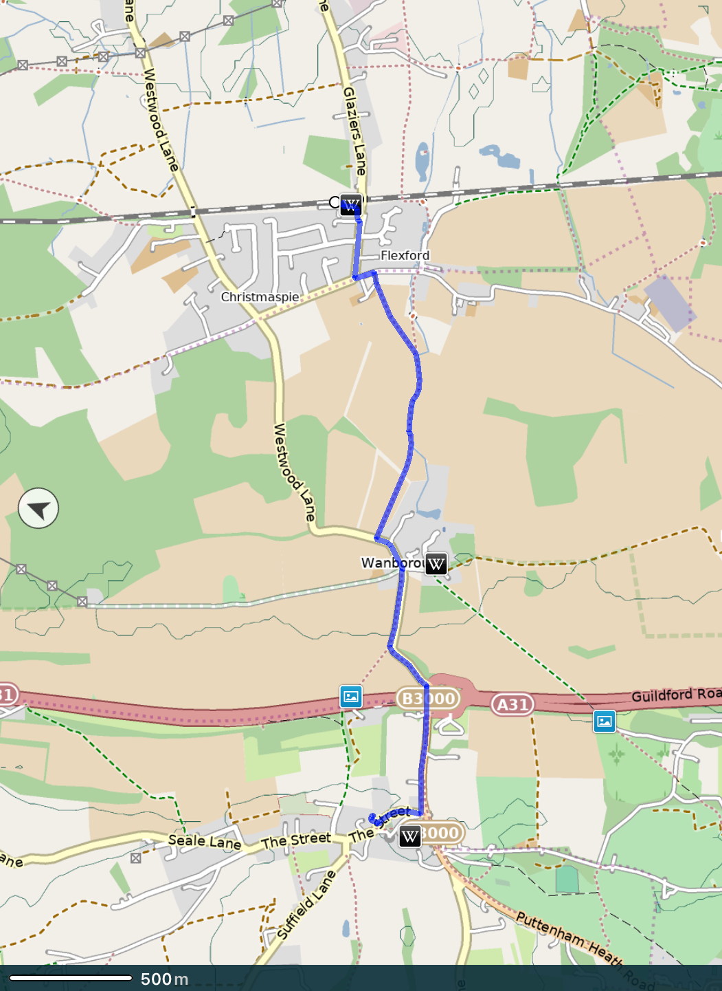
This 3.5 km walk is partly on unsurfaced paths not suitable for pull-along wheeled cases. We suggest using it as walking to the bunkhouse following local roads is not recommended as the lack of pavements makes those roads hazardous. We have a map as well as the following directions.

Leave Wanborough Station and go up to Glaziers Lane where it crosses the railway at a bridge near the station that can be seen from both platforms.

On reaching Glaziers Lane, turn right and after 300 m reach a ‘T’ junction on a sharp righthand bend. Turn left into Flexford Road and after 100 m turn right on a footpath through a gate. This is part of the Fox Way national trail. Follow the most obvious route.

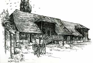
Ahead, the flanks of a hill called The Hog’s Back can be seen - this is the objective. Puttenham Barn is on the other side.

Maintain the same direction when after 400 m the path merges with another. The way skirts the edge of a field following the route of a hedgerow with mature trees bordering a stream.

Eventually reach Westwood Lane where an old farm trailer guards the entrance to the field.

Cross the lane with care to the other side where a pavement starts for walkers going up the Hog’s Back. This is Wanborough.

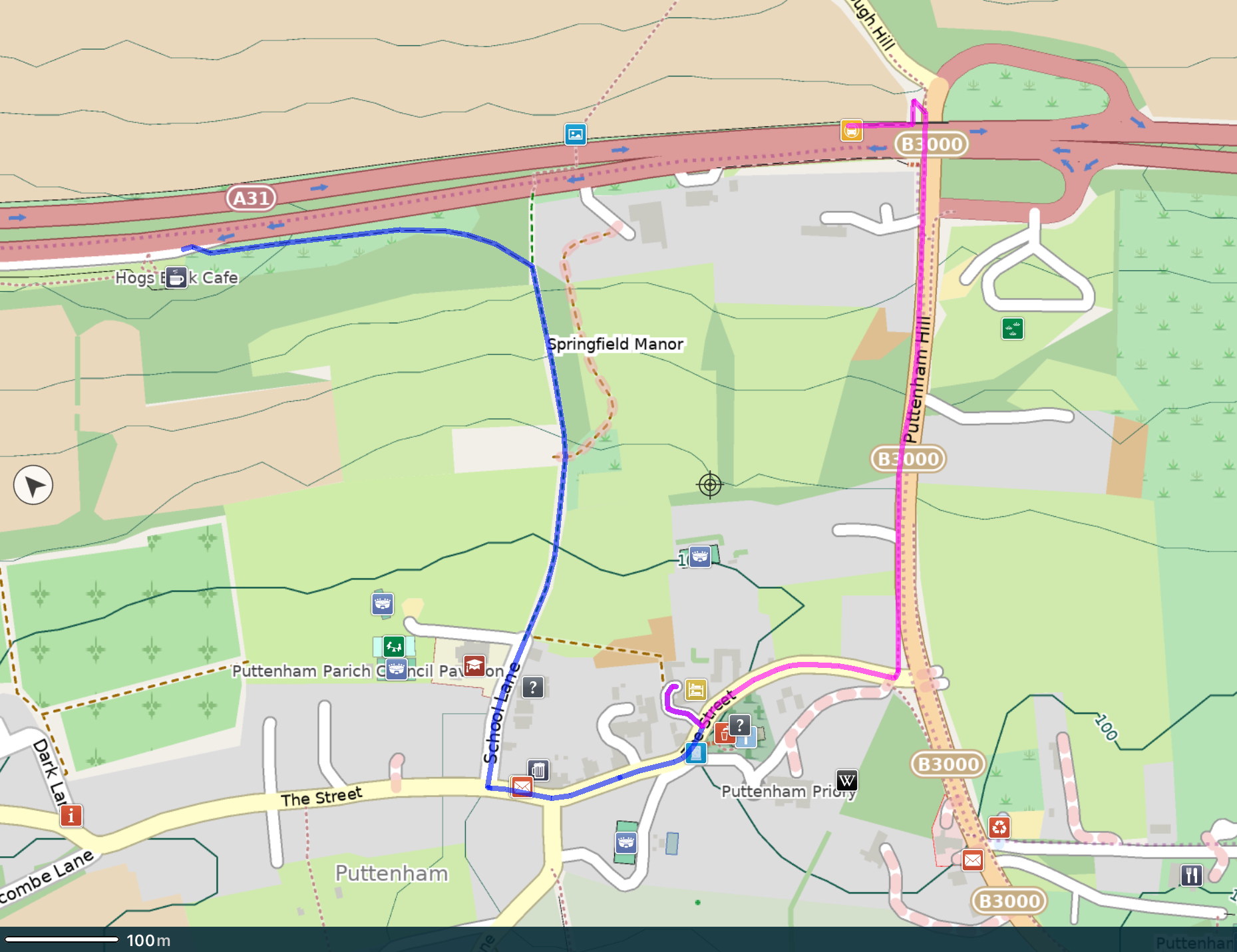
Staying on the pavement, climb the hill to the top (ignoring a footpath on the right) to reach a major road junction. Turn right and walk under the A31 and down the slope on the other side.

The first road on the right is The Street (the main road through Puttenham). Reach the entrance to the barn on the right after 400 m, opposite the church.

The bunkhouse is on the far side of the barn building, and is not visible from the road.

walking map

We created a booklet to help you find the route back from the barn to Farncombe station - download and print double-sided on A4 paper, then fold the sheets in half and put them in order.

Or you can look at the route on plotaroute.com (route ID 405130) and use the interactive map.

This guide was updated in December 2022. When printing, you may need to select "Layout: Two-sided: Short-Edge binding" or the equivalent to create the correct orientation.

We created a booklet to help you find the route from Godalming station to the barn - download and print double-sided on A4 paper, then fold the sheets in half and put them in order.

Or you can look at the route on plotaroute.com (route ID 365296) and use the interactive map.

This guide was updated in December 2022. When printing, you may need to select "Layout: Two-sided: Short-Edge binding" or the equivalent to create the correct orientation.

Thanks to Martyn Sandford and Dave Williamson for creating these walking routes from nearby stations. With a little bit of improvisation these routes work in the opposite directions too. Farncombe and Godalming stations are about one mile (1.6 km) apart on the same rail line between London Waterloo and Haslemere.

Bus: Details from Stagecoach.

Route 65 runs along the A31 between Guildford and Farnham, and the stops are short walks from the barn. Buses now also run on Sundays. There are directions below as the bus stops are not opposite each other and the traffic on the A31 is too fast to cross the road safely.

From Farnham head east towards Guildford and ask to go to the "Puttenham Crossroads". It's then a 10 minute walk. Use the nearby B3000 road underpass safely to cross the main A31 road, and take the next right turn towards Puttenham.

From Guildford head west towards Farnham and ask to go to the "Hog's Back Café" - about 15 minutes walk from the barn.

A tip from a visitor:

Although it is not obvious, you can also walk to the barn from the Hog's Back Café without having to walk along the busy road. You simply walk through the area with picnic tables in front of the cafe and there is a gate in the fence - then follow the hedge until there is a small wooded area in the way, at which point you veer to the right down a path that leads down the hill to the village.
Hogs Back to Puttenham Barn

Route 46 runs a more southerly route between Guildford and Farnham, and the best stop to use is that for Watts Gallery, Compton. From here follow the nearby bridleway west along the North Downs Way to Puttenham for about 2 miles. This may take 30 - 45 minutes to walk, and the route can be muddy.

National Rail Enquiries: Planning and booking for trains. Also by telephone: 03457 48 49 50.

Traveline: Integrated travel website.

Trainline: One-stop shop for train and coach travel.

Ride a cycle

Don't forget that when you ride your cycle here you can make free use of our wonderful lockable cycle shed. Our cycle shed is one of the finest in Surrey, designed by cyclists for cyclists, of ample size, with cycle racks inside yet still able to accommodate tandems or a tricycle. Depending on where you're coming from, you may be able to find quiet country lane routes and off-road bridleways to arrive here, instead of busy main roads.

For your smartphone or tablet...

We don't make a habit of recommending software, but there is one map app that is so good it deserves including. Pocket Earth is from a pair of outdoor nuts who call themselves Geomagik LLC, and is available for Apple devices now and Android is promised for the future. It uses OpenStreetMap information and includes easy downloading for off-line use. The basic app is free, but the paid Pocket Earth Pro app is seriously worth the small amount of money asked.